On December 19, 2023, the U.S. Department of State announced updated data on the outer limits of the U.S. continental shelf in areas beyond 200 nautical miles from the coast.
Since 2003, U.S. government agencies have been engaged in gathering and analyzing data to determine the outer limits of the U.S. extended continental shelf. This month’s announcement is the product of that two-decade collaboration among the Department of State, National Oceanic and Atmospheric Administration (NOAA) and the U.S. Geological Survey.
The U.S. continental shelf beyond 200 nautical miles is known as the extended continental shelf or ECS. The continental shelf is the extension of a country’s land territory under the sea. Like other countries, the United States has rights under international law to conserve and manage the resources and vital habitats on and under its ECS.
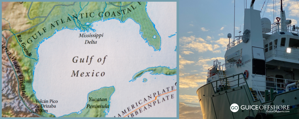
The U.S. ECS is approximately 1 million square kilometers (more than 386,000 square miles–an area about twice the size of California) and spread across seven offshore regions. It supports many resources (e.g., coral, crabs) and vital habitats for marine life. Those regions include the Arctic, Atlantic (east coast), Bering Sea, Pacific (west coast), Mariana Islands and two areas in the Gulf of Mexico.
For printable, poster-size maps of the updated ECS in all seven areas, among other resources like coordinates, click HERE.

Determining the ECS outer limits requires data on the depth, shape, and geophysical characteristics of the seabed and subsoil. NOAA and the U.S. Geological Survey (USGS) were responsible for collecting and analyzing the necessary data. This process began in 2003 and constitutes the largest offshore mapping effort ever conducted by the United States.
The United States may also have ECS in other areas, and the U.S. ECS Project continues to analyze available data and undertake analysis in a range of areas.
The United States has determined its ECS limits in accordance with customary international law, as reflected in the relevant provisions of the 1982 United Nations Convention on the Law of the Sea, and the Scientific and Technical Guidelines of the Commission on the Limits of the Continental Shelf.
Under customary international law, as reflected in Article 76 of the 1982 Law of the Sea Convention (Convention), the continental shelf consists of the seabed and subsoil that extends (1) to the outer edge of the continental margin, or (2) to a distance of 200 nautical miles from the coast if the outer edge of the continental margin does not extend up to that distance. This legal definition is different from the geological definition of a continental shelf.
The sovereign rights and jurisdiction of a coastal State over its continental shelf are reflected in the Convention and include the following:
- Conservation, management, and use of living and non-living resources
- Regulating marine scientific research
- Construction, operation, and use of artificial islands, installations, and structures
- Delineating the course for laying pipelines
- Drilling for any purpose
- Prevention of marine pollution in connection with some activities
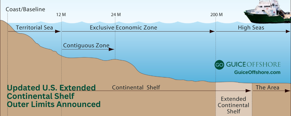
Note that the continental shelf and the exclusive economic zone (EEZ) are distinct maritime zones (Figure 1). The continental shelf includes only the seabed and subsoil, whereas the EEZ also includes the water column. In addition, while the maximum extent of the EEZ is 200 nautical miles from the coast, the continental shelf may extend beyond 200 nautical miles, depending on the depth, shape, and geophysical characteristics of the seabed and sub-sea floor. The ECS is, therefore, not an extension of the EEZ, as noted by the Department of State. Some of the rights that a coastal State may exercise in the EEZ, especially rights over water column resources (e.g., fish), do not apply to the ECS.
To go to the Department of State landing page with extensive information on the U.S. Extended Continental Shelf Project, click HERE.


