Fugro, the world’s leading Geo-data specialist, announced during October 2026 that it has been selected by the National Oceanic and Atmospheric Administration (NOAA) to deliver critical seafloor mapping data along Florida’s Atlantic coast, supporting safe navigation, maritime operations and updated nautical charts across one of the United States’ busiest coastal regions.
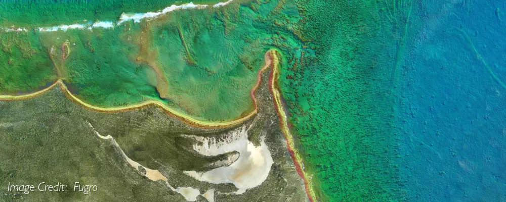
Under the contract, Fugro will conduct hydrographic surveys across approximately 3,200 square kilometres of Florida’s Atlantic waters. The data will be used by NOAA’s Office of Coast Survey to update nautical charts that support commercial shipping, government operations, recreational boating and other maritime activities that are essential to the region’s economy.
As severe storms and commercial expansions rapidly reshape Florida’s coastlines, accurate seafloor data is vital for maritime safety and economic stability. NOAA’s continuous hydrographic updates directly protect billions in trade along the Atlantic and Gulf Intracoastal Waterways, prevent hazardous groundings in shifting shallow inlets, and provide the precise bathymetry needed to shield vulnerable marine ecosystems.
“Reliable Geo-data is essential for safe navigation, efficient maritime operations and understanding how our coastal environments are changing over time,” said Céline Gerson, Group Director, Americas. “We are proud that NOAA has once again selected Fugro to support this important work. By combining our expertise in hydrography, advanced mapping technologies and data analytics, we are helping provide the accurate information that mariners, coastal communities and decision-makers depend on.”
The project builds on Fugro’s longstanding relationship with NOAA and follows the company’s recent hydrographic survey work along Florida’s Gulf Coast. Fugro has been supporting marine mapping initiatives throughout Florida and the wider United States. As part of the Florida Seafloor Mapping Initiative, Fugro has contributed to the mapping of more than 56,000 square kilometres of Florida waters, helping create one of the most comprehensive collections of seabed data in the region.
Fugro provides rapid support to Florida authorities to help prioritize recovery following Hurricane Isaias
On Florida’s West Coast, Fugro reported on November 2, 2026 that it had rapidly mobilized airborne mapping resources for the Florida Department of Transportation (FDOT) to support the state’s response to Hurricane Isaias, which made landfall near Pensacola, Florida on October 9, 2026 accompanied by destructive winds and a large storm surge
By capturing high-resolution lidar data and aerial imagery immediately before and after the hurricane made landfall, Fugro provided timely Geo-data to help assess changes across vulnerable coastal areas and inform recovery planning.
As Hurricane Isaias approached Florida’s Gulf Coast, FDOT requested an urgent survey of coastal areas near the storm’s anticipated landfall in the Florida Panhandle. Within 13 hours of receiving the request, Fugro had developed an operational plan, mobilised aircraft and personnel, secured flight approvals and deployed to the survey area.
Fugro conducted aerial mapping missions on the day before and two days after the hurricane made landfall. Hurricane Isaias came ashore near Destin on 9 October as a Category 2 hurricane, with maximum sustained winds of 105 mph. It caused widespread damage and left hundreds of thousands of customer accounts without power across Florida. Across approximately 150 square miles and a 70-mile stretch of coastline and barrier islands, Fugro collected 20-point-per-square-metre topographic lidar data and four-band aerial imagery. Processing through Fugro’s ROAMES® platform enabled the rapid delivery of survey products, including analysis showing changes between pre- and post-storm conditions.
The resulting information provides state agencies with a consistent view of conditions immediately before and after the storm, supporting infrastructure assessments, recovery prioritisation and longer-term resilience planning. Despite challenging weather and operational constraints, Fugro completed surveys of the full area of interest twice, including authorised operations within military-restricted airspace.
“Rapid access to reliable Geo-data is critical when communities are preparing for and responding to severe weather,” said Keith Owens, Fugro’s Commercial Director for Americas Remote Sensing & Mapping / Power. “The dedication and close coordination of our airborne operations, survey and data-processing teams enabled us to provide FDOT with timely information to support decision-making before and after the storm.”