NOAA’s National Coral Reefs Monitoring Program (NCRMP) launched a new data visualization tool on November 15, 2023 that will provide free and easy-to-access information on the status of U.S. coral reefs. It is the first tool focusing on shallow tropical coral reef data to be hosted on the NOAA GeoPlatformoffsite link, which is NOAA’s central hub for geospatial data and tools.
Now stakeholders, scientists, managers and students have a one-stop information hub to access and understand NOAA’s shallow tropical coral data that they can customize to focus on coral trends across specific timescales, locations, coral or fish species, climate data and socioeconomics.
The National Coral Reef Monitoring Program is a strategic framework for conducting sustained observations of biological, climatic, and socioeconomic indicators in U.S. states and territories. The resulting data provide a robust picture of the condition of U.S. coral reef ecosystems and the communities connected to them. Recognized both nationally and internationally, the NCRMP is one of the only coral reef monitoring programs in the world to directly include a human dimensions component with biophysical monitoring.
CoRIS (Coral Reef Information System) is the Coral Reef Conservation Program’s information portal that provides access to NOAA coral reef information and data products with emphasis on the U.S. states, territories, and remote island areas.
“NOAA’s coral monitoring activities represent a truly comprehensive array of data and information — from biological and physical characteristics of reefs to insights into how surrounding communities perceive and protect their reef resources,” said Nicole LeBoeuf, assistant administrator, NOAA’s National Ocean Service. “This user-friendly tool represents a leap forward in making our extensive data accessible and analysis-ready.”
NCRMP is one of the few initiatives in the world to integrate a human dimensions component of research into a coral reef ecosystem monitoring program. This data visualization tool is the first NOAA coral product to feature social parameters as part of a comprehensive analysis of coral status. It can be used to see how residents interact with coral reefs and examine their perceptions of coral reef conditions over time, which are key data points for managers who develop locally-appropriate conservation and management strategies.
Accessing data is a key component of this new visualization tool. For the first time, users can download streamlined data summaries for each available year at different geographic scales. Users asked for and received ways to filter and download data in an easy-to-understand format, allowing researchers and decision-makers to develop custom datasets with actionable, situation-specific information.
“This tool is a game-changer,” said Jennifer Koss, director of NOAA’s Coral Reef Conservation Program. “To have this data available in an accessible, visual format will enable scientists and managers to make on-the-ground assessment and conservation decisions more easily. This is also a chance for researchers, students and engaged conservationists to gain an understanding of U.S. coral reef ecosystems and how people value them.”
The tool covers data collected since 2013 across four themes: benthic communities (corals, macroalgae and more); fish populations; climate and ocean chemistry; and socioeconomics. It encompasses the diverse range of coral reefs within the nation’s states and territories of Florida, the U.S. Virgin Islands, Puerto Rico, Hawaii, American Samoa, Guam and the Commonwealth of the Northern Mariana Islands. It also includes data from Flower Garden Banks, Florida Keys, and Hawaiian Islands Humpback Whale National Marine Sanctuaries, the National Marine Sanctuary of American Samoa, the Pacific Remote Islands and Papahānaumokuākea Marine National Monuments.
The NCRMP’s new data visualization tool is a portal into NOAA’s vast portfolio of information on coral reef status and trends, and a powerful tool for ongoing efforts to conserve these remarkable and fragile ecosystems. Access the NCRMP data visualization tool at ncrmp.coralreef.noaa.gov and learn more by watching this video or reading the tutorial.
Coral reefs are among the most valuable ecosystems on earth, providing people with goods and services that include food, storm protection, and recreational opportunities. Despite their importance, coral reef ecosystems are in decline due to a myriad of man-made and natural threats.
In response, the NOAA Coral Reef Conservation Program established the NCRMP, an integrated and focused monitoring effort with partners across the U.S. and a strategic framework for conducting sustained observations of biological (benthic and fish), climatic, and socioeconomic indicators in U.S. states and territories. The resulting data provide a robust picture of the condition of U.S. coral reef ecosystems and the communities connected to them.
To learn more about NCRMP, read the strategic plan.
NOAA scientists have tracked a steady climb in ocean temperatures since April 2023, which is causing unprecedented heat stress conditions in the Caribbean Basin, including waters surrounding Florida and in the Gulf of Mexico.
More isolated marine heat wave conditions have been detected off the Northeast U.S. coast, along the path of the Gulf Stream. NOAA has also been monitoring a large marine heat wave in the Northeast Pacific (in the Gulf of Alaska) that has been sitting offshore since late 2022.
As we gather more data about these events, NOAA scientists are providing answers to big questions about marine heat waves:
What are marine heat waves?
Marine heat waves are usually defined as any time the ocean temperature is above the 90th percentile for a specific length of time. This means that the temperatures are warmer than 90% of the previous observations for a given time of year. Marine heat waves can last for weeks, months or years. Marine heat wave conditions are monitored by NOAA’s Physical Sciences Laboratory (PSL) and NOAA Coral Reef Watch.
How are marine heat wave observations and measurements made?
The National Weather Service’s National Data Buoy Center collects and disseminates real-time quality-controlled marine observations using 1,300 weather observing stations. Global ocean surface temperatures are also monitored daily using blended satellite measurements.
Why is this marine heat wave in South Florida significant?
In the last week (as of this writing), water temperatures throughout the Gulf of Mexico and in the Caribbean Sea have been approximately 1.8-5.4˚F (1-3˚C) warmer than normal. Temperatures around Southern Florida are the warmest on record (going back to 1981). The latest conditions can be seen on the NOAA PSL Map Room webpage.
Given that we are in the thick of the Atlantic hurricane season and the tropical North Atlantic is already warm, extremely warm ocean temperatures in the Caribbean and the Gulf of Mexico are concerning. Developing tropical storms that pass into the region may strengthen as a result of these conditions. The ongoing marine heat wave in South Florida could impact sensitive marine ecosystems in the region, such as shallow water corals.
How long has the marine heat wave been going on? How long will this heat wave last?
The current Gulf of Mexico marine heat wave has been present for several months, beginning in February/March of 2023. NOAA’s experimental marine heat wave forecasts indicate a 70-100% chance that extreme ocean temperatures will persist in the southern Gulf of Mexico and Caribbean Sea through at least October 2023. We have low-to-medium confidence in this prediction given the historical skill of the forecasting system in these regions.
What role does climate change play in this marine heat wave off Florida?
The ocean absorbs 90% of the excess heat associated with global warming. As a result, we know that marine heat waves all over the planet are becoming warmer over time. The absolute temperature of the current event is warmer because of climate change, but it would have likely still occurred without climate change.
Warming trends also impact our marine heat wave prediction systems, typically by increasing the probability of marine heat waves in our forecasts.
How are corals and marine ecosystems impacted by marine heat waves?
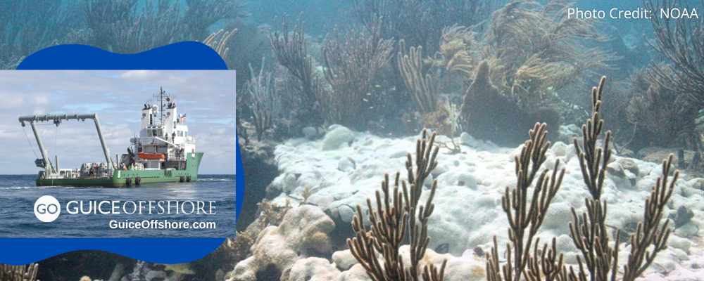
Marine heat waves cause stress to corals and other marine ecosystems. Exposure to extreme temperature for long periods of time causes a breakdown in the relationship between coral and the algae that live inside of them. The coral is left pale or white, i.e., bleached. The lack of food from the algae can lead to the death of the coral.
If the heat stress does not subside, the coral will die. Mortality becomes likely if the corals experience ocean temperatures of 1°C greater than the historical maximum monthly average for two months, or 2°C greater than the historical maximum monthly average for one month.
How does NOAA anticipate these marine heat waves may impact fisheries and ecosystems?
Extreme heat can be destructive and deadly for marine systems. An unprecedented marine heat wave known as “the Blob” dominated the northeastern Pacific from 2013 to 2016, and upended ecosystems across a huge swath of the Pacific Ocean. This led to an ecological cascade, causing fishery collapses and fishery disaster determinations.
“The Blob” caused whales’ prey to be concentrated unusually close to shore, and a severe bloom of toxic algae along the coast delayed opening of the valuable Dungeness crab fishery. Humpback whales moved closer to shore to feed in some of the same waters targeted by the crab fishery, resulting in a then-record 53 whale entanglements in 2015 and 55 in 2016.
Guice Offshore Vessels Work With Scientific and Government Researchers; Even Documentary Filmmakers
Guice Offshore (“GO”)’s fleet is regularly employed in a variety of support roles including ocean science research and development, and other special projects requiring top-of-the-line, highly dependable offshore support vessels. Our multi-purpose vessel GO America, based in Port Everglades, Florida, operates in conjunction with our partners Global SubDive to support a large array of science and research projects, often utilizing GSD submarines and ROVs. Similarly, partner Ryan Marine is an expert in the field of unmanned vehicle operation, which allows us to provide turnkey AUV and UUV services anywhere in the United States and Caribbean.
Guice Offshore vessels like the 150 ft. DP1 GO Liberty or the 170 ft. DP1 GO Discovery are often used by geotechnical and other types of companies to perform detailed survey activities such as seabed mapping, soil investigations and core sampling. Depending on their equipment installed, our vessels can work in a variety of coastal or offshore environments and water depths. The open cargo deck, ample accommodations, excellent maneuverability and station-keeping, all coupled with an efficient cost of operations, makes the Guice Offshore fleet a consistently reliable choice for those needing an offshore supply vessel or marine transport.
For researchers looking to document their missions, Guice Offshore vessels also support movie and television productions, whose crew needs capable vessels like ours to film scenes, house crews or transport between sets. Our vessels have participated in the filming of feature films movies Deepwater Horizon and Isolation. GO America was also supporting actor in the TV series Cooper’s Treasure Season 2 and Shark Week’s “Tiger Shark King” episode. GO vessels have even been mentioned on national news programs for their participation in life-saving rescues or other offshore recovery missions. With our partners, submarines and ROVs can be provided to assist with underwater cinematography.


